Introduction
The Stanford Spatial History Projects seem to be in a rough state without Adobe Flash. Three projects I found interesting turned out to be malfunctioning, but I eventually tracked down two which I could draw a comparison between. I landed on “Geography of Chinese Workers Building the Transcontinental Railroad,” an effort to reconstruct the areas Chinese workers were present in during construction, and “Richard Pryor’s Peoria,” a documentation project surrounding Peoria, Illinois during the time Richard Pryor lived there.
Geography of Chinse Workers Building the Transcontinental Railroad
The Railroad project is designed to allow users to follow the exact route of the Transcontinental Railroad. The webpage repeatedly provides 3D overviews of the route through Google Earth, which can in turn be accessed through the link on screen, allowing users to jump to the same view and manipulate the map to further study the modern terrain.
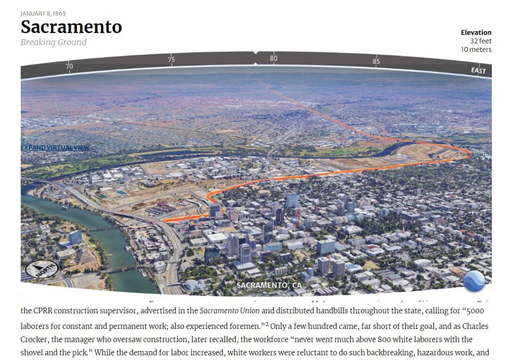
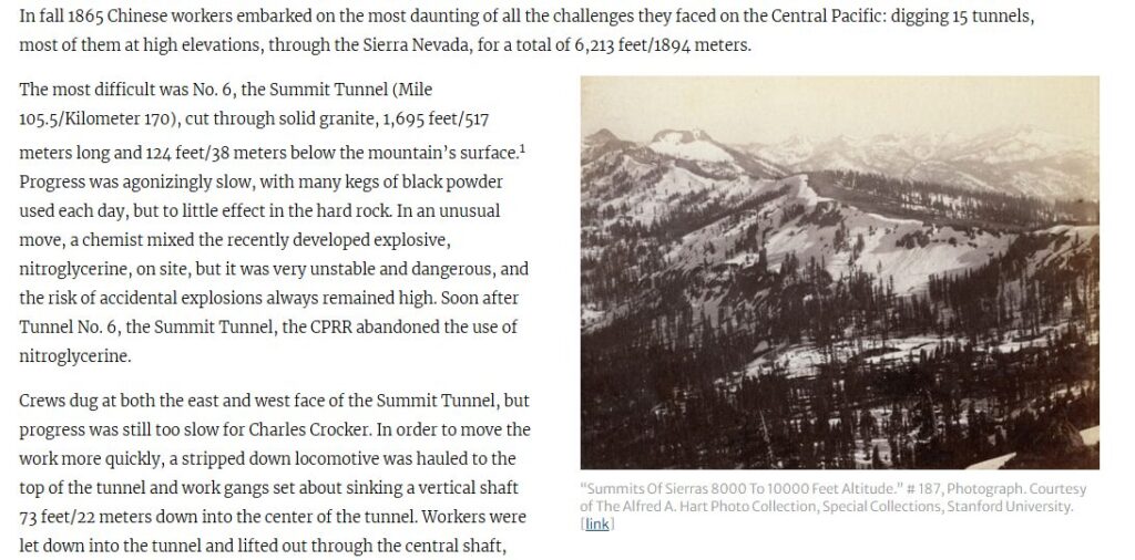
Interspaced between these assets are contemporary photos of the period described in the text which are as closely associated with the mapped locations as possible. These images have no interactive component but provide important context to the original terrain prior to the construction of the railroad or other infrastructure.
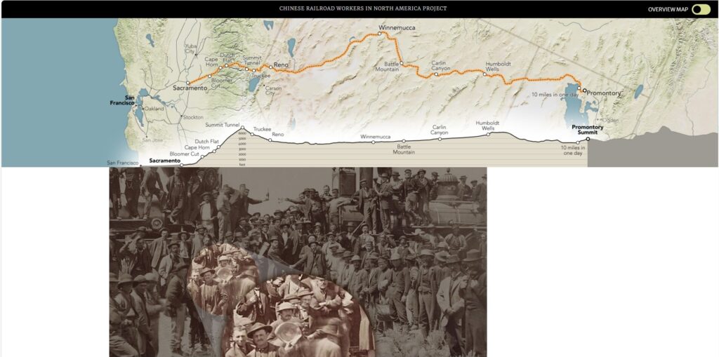
Throughout all of this, users are given the option to toggle a map which will track their physical progress along the railroad route as they scroll through the project page. This seems to be the most unique and interesting feature implemented on this project and is remarkably helpful once users get used to it.
Richard Pryor’s Peoria
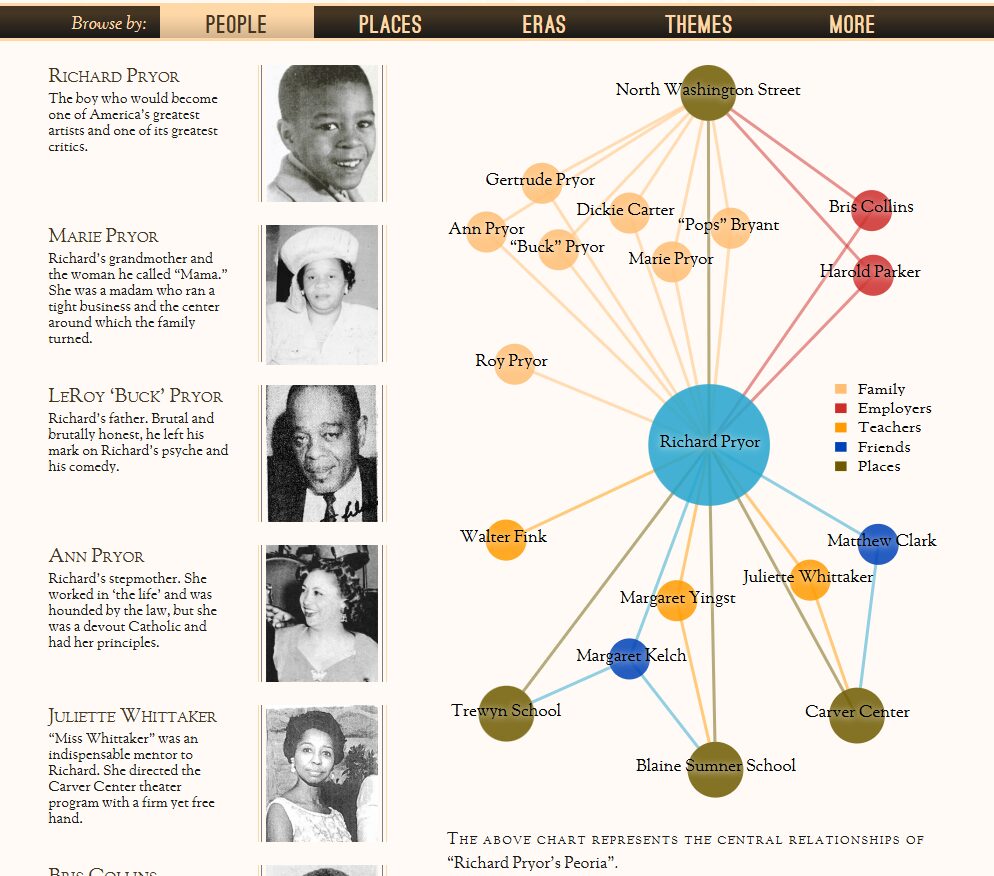
The Peoria website is an archive of source documents stretching from 1919 to roughly 1980 (while a few documents postdate this period, they are collected in a brief closing section). From the home page, the site allows users to filter based on several overlapping criteria: People, Places, Eras, or Themes (the “More” heading, confusingly, acts as the home page).
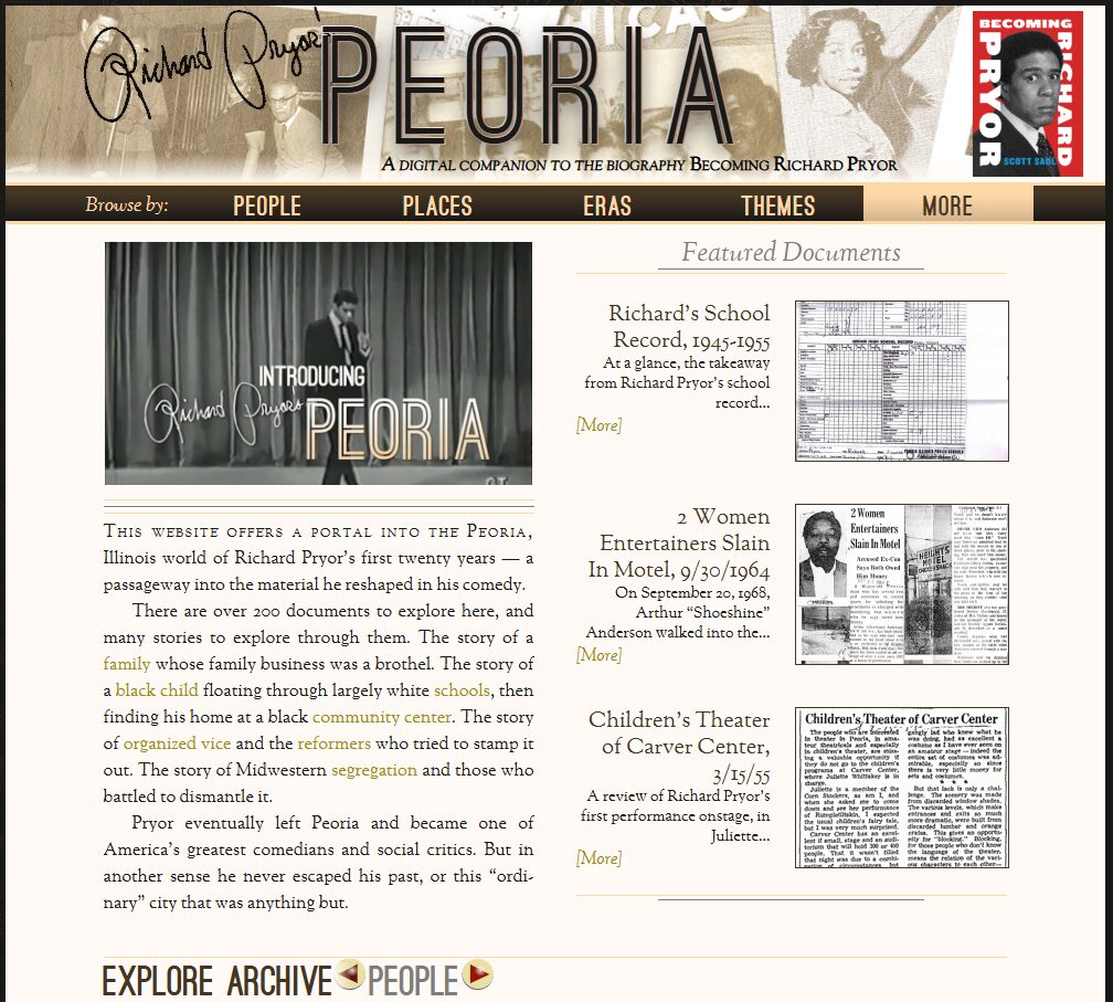
The site is focused definitively on Pryor himself, with most of the documents provided linking to him or framed by his life. There are a few documents which have little connection to Pryor; the project seems to have been willing to include any additional information they received on the topic of Peoria even if it didn’t personally impact Pryor, but it does not appear to have such sources out. The below diagram, for example, displays that all individuals in the “People” heading are of some relationship to Pryor.
Comparison
The two websites discussed above serve vastly different purposes. The former is a mapping project overlaying historical activities onto the current physical world. The latter is an archive of sources on a particular city. Both are “spatial” history projects, attempting to make an area more legible to modern users, but they have vastly different approaches.
The user interface for the Railroad project has a slight learning curve and can appear almost broken at first; the various links and hovering mapping feature do not move the way the webpage seems it should. After a couple minutes practicing, however, the benefits of their system far outweigh the time spent to learn it, allowing users to see multiple types of information on screen at the same time.
By contrast, the Peoria website is remarkably user friendly, allowing documents to be found by effectively any criteria. The multiple approaches create redundancies, but the site’s relatively few documents prevent this from becoming a problem. While it would likely scale poorly, the current layout of the Peoria website is excellent for its purpose.